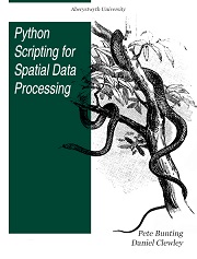
Python Scripting for Spatial Data Processing

简介:
本书是初学者的Python教程,旨在教授空间数据处理。它被用作英国阿伯里斯特威斯大学遥感和地理信息系统课程的一部分。地理信息系统属于处理空间数据的应用程序。对于不同的区域或地区,某些空间分析以相同的方式重复进行。因此,当数据处理可以由特别为批量数据处理设计的程序扩展自动运行时是有用的。我们使用Python自动将数据流图转换为程序代码,使用psycopg2和ogr2ogr等。
英文简介:
This book is a Python tutorial for beginners aiming at teaching spatial data processing. It is used as part of the courses taught in Remote Sensing and GIS at Aberystwyth University, UK.
Geographic information systems belong the group of applications that process spatial data. Some spatial analyses are operated repetitively in the same way for different area or district. Therefore it is useful when the data processing can be run automatically by program extension designed especially for batch data processing. We use Python to automatically convert data flow diagram into the program code, using psycopg2, and ogr2ogr, etc.
- 书名
- Python Scripting for Spatial Data Processing
- 译名
- 用于空间数据处理的 Python 脚本
- 语言
- 英语
- 年份
- 2013
- 页数
- 194页
- 大小
- 695.30 kB
- 标签
- Python
- 下载
 Python Scripting for Spatial Data Processing.pdf
- 密码
- 65536
最后更新:2025-04-12 23:54:38